Skip to content
Bundle offer: all three books for $35$50 separatelySee the offer

A three-volume illustrated atlas · 2026

Read the ground under America’s oil fields and mines.

Three books and 66 districts, from the Drake Well in 1859 to lithium at Thacker Pass. Each district gets its history, a reference map, a geological model and a production table with the source named.

One-time payment. $50 if bought separately. 30-day money-back guarantee.

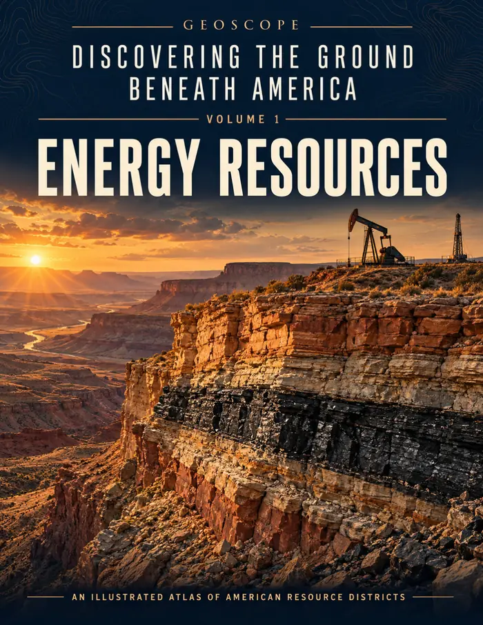
Cover of GeoScope Volume 1, Energy Resources: a layered canyon wall at sunset with an oil pumpjack on the rim.
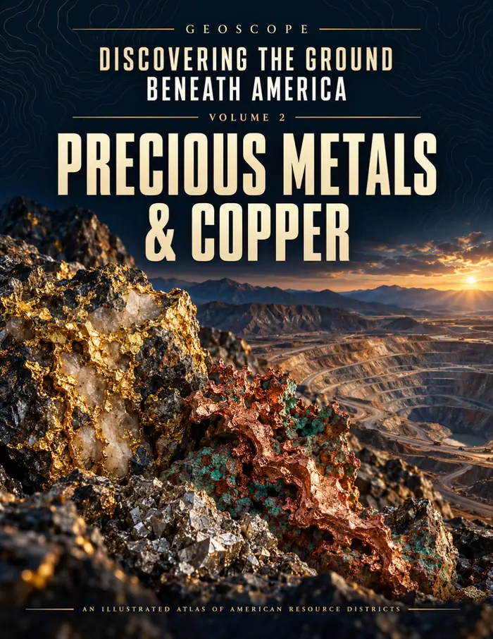
Cover of GeoScope Volume 2, Precious Metals & Copper: a close-up of gold and copper-bearing ore against a desert canyon.
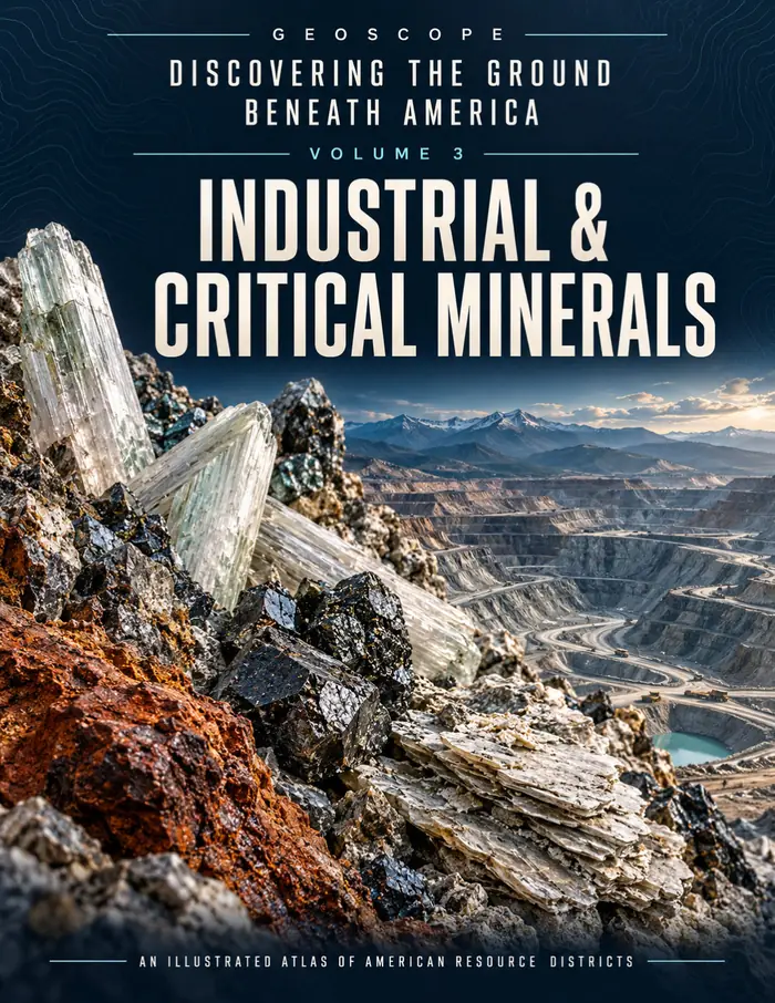
Cover of GeoScope Volume 3, Industrial & Critical Minerals: pale quartz crystals and mineral-stained rock above an open-pit mine.
illustrated books
3
resource districts
66
pages, US Letter
636
sourced production tables
66

Why this atlas

The story and the numbers, on facing pages.

Most writing about American oil and mining picks a side. Histories tell you about the gusher at Spindletop and leave the barrels vague. Statistical tables give you the barrels and none of the place.

GeoScope keeps both. Every chapter opens with how the district was found, shows where it sits on a USGS base map, draws the rock that holds the resource, and ends with production figures that say exactly what they count.

That last part matters more than it sounds. A pipeline total is not a field total. A resource is not a reserve. The tables say so, line by line.

One chapter, start to finish

Prudhoe Bay, in four pages.

Chapter 06 of Volume 1 follows the largest oil field found in North America at the time of its 1968 discovery. Every chapter in all three books is built the same way.

  1. The history

    It starts with the discovery.

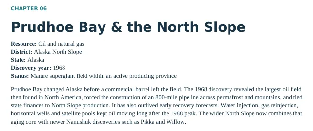
    On March 13, 1968, ARCO and Humble announced the Prudhoe Bay find. The opener sets out the resource, state, discovery year and current status before the story begins, then a key-facts table says what each figure covers.

    Chapter 06 opener: Prudhoe Bay and the North Slope. Resource oil and natural gas, district Alaska North Slope, discovery year 1968, status mature supergiant field, followed by the opening paragraph.
    Detail from Volume 1, page 51
  2. The place

    Then the map.

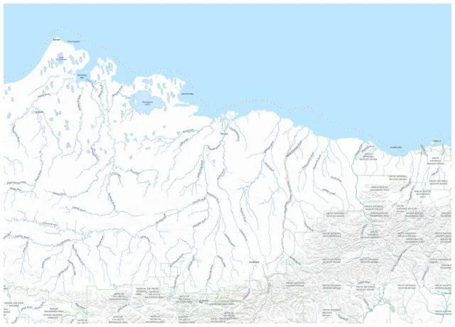
    A geographic plate on USGS National Map base imagery places the field on Alaska’s Arctic coastal plain, along the Beaufort Sea. North is up, and the panel is about 596 km wide.

    Geographic plate of Alaska’s North Slope on USGS National Map imagery: the Beaufort Sea across the top, the coastal plain cut by north-flowing rivers, and foothills along the bottom edge.
    Detail from Volume 1, page 53. Base imagery: USGS National Map.
  3. The geology

    Then the rock.

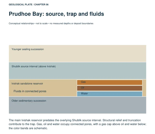
    A labelled geological plate shows the Shublik source interval over the Ivishak sandstone reservoir, with gas above oil above water in connected pores. It is marked as a teaching diagram, not to scale.

    Geological plate titled Prudhoe Bay: source, trap and fluids. Labelled layers from top: younger sealing succession, Shublik source interval, Ivishak sandstone reservoir holding gas over oil over water, and older sedimentary succession.
    Detail from Volume 1, page 55. Teaching diagram; not to scale.
  4. The numbers

    Then the production.

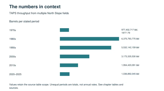
    Trans Alaska Pipeline throughput by period, summed from Alyeska’s annual table: 6.38 billion barrels in the 1980s, 1.04 billion in 2020 to 2025. The caption notes these are multi-field totals, not Prudhoe alone.

    Bar chart of Trans Alaska Pipeline throughput by period: about 0.98 billion barrels in 1977 to 1979, 6.38 billion in the 1980s, 5.53 billion in the 1990s, 3.17 billion in the 2000s, 1.95 billion in the 2010s and 1.04 billion in 2020 to 2025.
    Detail from Volume 1, page 58

From the books: geographic plates reproduce USGS National Map base imagery. They locate districts but do not map legal, resource, lease or deposit boundaries. Geological plates are conceptual illustrations, not measured cross-sections.

Three books, 66 chapters

From Titusville to Thacker Pass.

Each volume stands on its own. Together they cover every district in the atlas, numbered 1 to 66.

Cover of Volume 1, Energy Resources

Volume 1

Energy Resources

Chapters 1–24 · 24 districts · 237 pages

Corrected review edition, October 8, 2026

The Drake Well and Spindletop, the Permian and the Bakken, Marcellus gas, Powder River coal and the uranium belts of the Colorado Plateau. This volume is a corrected review edition.

Buy this book · $20
Cover of Volume 2, Precious Metals & Copper

Volume 2

Precious Metals & Copper

Chapters 25–45 · 21 districts · 202 pages

September 2026 text and figures

Gold from the Reed Mine and the Mother Lode to the Carlin Trend, Comstock and Leadville silver, Stillwater platinum, and the great copper districts at Butte, Bingham Canyon and Morenci.

Buy this book · $15
Cover of Volume 3, Industrial & Critical Minerals

Volume 3

Industrial & Critical Minerals

Chapters 46–66 · 21 districts · 197 pages

September 2026 text and figures

The iron ranges of the Lake Superior country, lead and zinc from Missouri to Red Dog, lithium at Thacker Pass, rare earths at Mountain Pass, and the borates, trona, phosphate and potash industry runs on.

Buy this book · $15

From the chapters

Written to be read, not just looked up.

The Drake Well did not reveal that petroleum existed. Oil had seeped from the ground along Oil Creek for centuries, and the Seneca collected it for practical and medicinal use.

Chapter 01 · Drake Well & the Pennsylvania Oil Region · Volume 1, p. 5

Homestake is no longer a gold mine: its commercial gold output is zero. Its depth, excavated over generations to reach ore, has become shielding from cosmic radiation for a different kind of search.

Chapter 27 · Homestake · Volume 2, p. 25

Mesabi’s history contains two different mining industries. The first exploited naturally enriched ore. The second learned to concentrate iron from much leaner, harder taconite.

Chapter 47 · Mesabi Range, Minnesota · Volume 3, p. 14

A stained creek can tell a prospector where to look. It cannot establish the thickness of mineralization, the continuity of a buried layer, or whether enough valuable material exists to pay for a mine.

Chapter 53 · Red Dog, Alaska · Volume 3, p. 69

Look inside

Select a page to see it full size. Use the arrow keys, or swipe on a phone, to move between pages.

From the books: geographic plates reproduce USGS National Map base imagery. They locate districts but do not map legal, resource, lease or deposit boundaries. Geological plates are conceptual illustrations, not measured cross-sections.

Who reads it

Made for people who like to know where things come from.

  • Geology students

    Sixty-six worked examples of how a trap, a vein or a placer becomes a district, each with the references to follow up.

  • Working geologists

    A desk reference for districts outside your own patch. Sandstone uranium, porphyry copper and Carlin-type gold sit side by side.

  • Energy and mining analysts

    Production series with their scope spelled out: statewide or district, gross or net, annual or cumulative. Less time reconciling.

  • History and map readers

    Boom towns, strikes, pipelines and company fights, set against real USGS topography rather than a cartoon map.

  • Teachers

    Ready-made case studies for earth science, economic history or geography. Each chapter stands on its own in a single lesson.

  • Anyone with one question

    Only care about copper, or coal, or critical minerals? Each volume is sold on its own, so you can start with the one you need.

How it was put together

Careful about what the numbers mean.

The atlas tells you what was checked, what was not, and where every figure comes from. These notes come straight from the “Reading this atlas” page in each book.

Volume 1 is a corrected review edition

All 24 energy chapters were reviewed against accessible historical, geological, regulatory and company sources, and major production series were recomputed where the tables could be retrieved. Revised October 8, 2026.

What the review covered

Volumes 2 and 3 were reviewed for structure, numbering, units, accounting scope and selected numerical conflicts. The books are plain that neither review certifies every statement independently.

No silent arithmetic

Unequal reporting periods, state proxies, partial years and ownership shares stay labelled. Cumulative checkpoints are not added to annual output, and resources are not added to reserves.

Sources in every chapter

Each of the 66 chapters ends with a numbered source list. Most figures trace to the EIA, the USGS, BOEM, state regulators and surveys, company filings, or historical Bureau of Mines records.

Units used

Short ton
2,000 lb
Long ton
2,240 lb
Metric tonne
1,000 kg
Troy ounce
31.1035 g
bbl
barrel
Mcf / Bcf / Tcf
thousand / billion / trillion cubic feet
koz / Moz
thousand / million troy ounces

Cited most often

  • U.S. Energy Information Administration (EIA)
  • U.S. Geological Survey (USGS)
  • Bureau of Ocean Energy Management (BOEM)
  • State regulators and geological surveys
  • Company annual reports and SEC filings
  • U.S. Bureau of Mines historical records

The offer

All three books, one honest price.

Pay once and keep the PDFs. No account, no subscription.

Bundle · save $15

GeoScope, all three volumes

$35Bought separately $50

What you get today

  • Volume 1: Energy Resources237 pages · chapters 1–24$20
  • Volume 2: Precious Metals & Copper202 pages · chapters 25–45$15
  • Volume 3: Industrial & Critical Minerals197 pages · chapters 46–66$15
  • Bonus: Free corrected editionsEvery future revision of all three books, sent to you freeIncluded
Bought separately
$50
You pay today
$35
Get all 3 books · $35
  • Instant download
  • Pay once, keep forever
  • DRM-free PDFs

Secure checkout through Gumroad · Cards and PayPal · 30-day refund

30-day money-back guarantee

Take a month with all three books. If the atlas is not what you hoped, write to us within 30 days and we will refund your payment in full. You do not need to give a reason.

Only need one book?

Each volume is sold on its own too. Bought separately the three cost $50, so the bundle saves $15.

Questions

Before you buy.

Three DRM-free PDF books, US Letter size (8.5 × 11 in), with a bookmark for every chapter. Volume 1, Energy Resources, has 237 pages. Volume 2, Precious Metals & Copper, has 202. Volume 3, Industrial & Critical Minerals, has 197.

Sixty-six districts. Three books. One shelf.

Get all three books for $35, or start with the one you need.